
Thompson Ridge Fire Has Explosive Growth
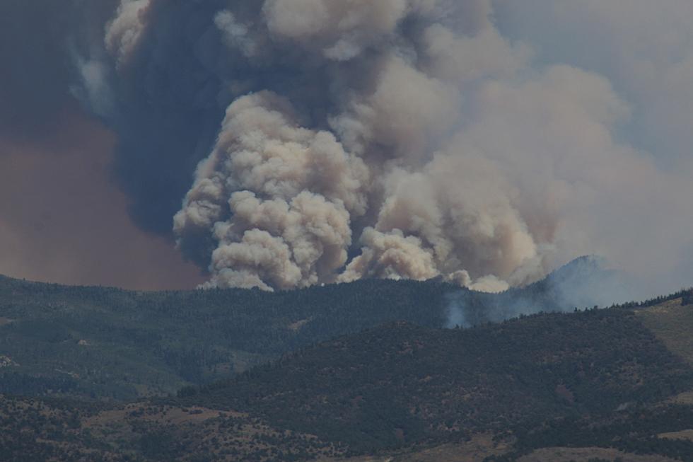
The Thompson Ridge Fire, burning in the Fishlake National Forest, has grown exponentially over the last 24 hours. Helicopter mapping form this morning now has the fire consuming 7,289 acres. The blaze is still listed at zero percent containment.
Fire activity increased substantially showing short crown runs, torching and spotting fire behavior. Overnight humidity decrease also proved to be a considerable contributing factor to the growth of the fire. Increased wind speeds throughout the day on Tuesday also fueled the growth.
Weather for today will also factor in to continued growth of the fire as relatively low humidity is in the forecast for the area today, along with gusty and variable winds. However, firefighters may catch some relief later this week as monsoonal moisture could return to the area for the end of the week.
The terrain where the fire is burning is providing a challenge to fire suppression efforts. The Thompson Ridge Fire is burning in steep, rugged area and transitioning to rolling pinyon juniper hills. Still, no structures are threatened at this point.
Seven engines have now been assigned to the fire, along with three bulldozers, four water tenders and four helicopters. Five crews consisting of 185 total personnel have now been assigned to the Thompson Ridge Fire. The fire is now considered a Type 4 incident.
Today, firefighters will be scouting for areas to begin creating new fire lines to work in conjunction with natural rock barriers. This will give them the greatest opportunity for containment. No timeline for containment has been presented at this time.
The fire is producing smoke visible throughout the region, and travelers on both Interstate 15 and U.S. Highway 89 will easily see smoke as they pass through either Beaver or Piute County.
Pushed by yesterday’s high winds, the Kane Fire burning near Jacob Lake, has been most active on the southeast corner near Kane Canyon. Southern winds drove the fire toward the east, producing an additional 40-50 acres of growth and visible smoke near the Kane Ranch.
Despite these conditions, the overall acreage of the fire decreased from the previous day due to more accurate mapping of the incident. Aerial observations from a reconnaissance flight and infrared mapping showed minimal heat on the north end of the fire and very little fire activity on the west side.
As the Kane Fire moves into Kane Canyon to the east, firefighters are increasing protections surrounding the historic Kane Ranch. In this area, crews are removing flammable vegetation and installing sprinklers to increase defensibility around these structures. At the canyon opening, firefighters are using hand tools to construct fireline by removing vegetation down to bare mineral soil to create a barrier to help prevent fire spread.
Crews are using bulldozers to maintain and improve the Buffalo Ranch Road to provide access for firefighters and also serve as a physical feature to stop the spread of fire. Fire managers will continue to assess current conditions and strategize future options to fully contain the fire while protecting valuable resources in the area.
A southerly flow from the Baja coast will bring moisture over the fire area today and Thursday. This system will bring a good chance of showers and thunderstorms throughout the day with a lower chance at night. Moisture will then decrease on Friday with only scattered showers and thunderstorms. Winds will be much weaker today compared to Tuesday.
LOOK: 20 photos of shipwrecks from WWI and WWII
More From Star 98

